 https://www3.nhk.or.jp/news/html/20220513/k10013623961000.html
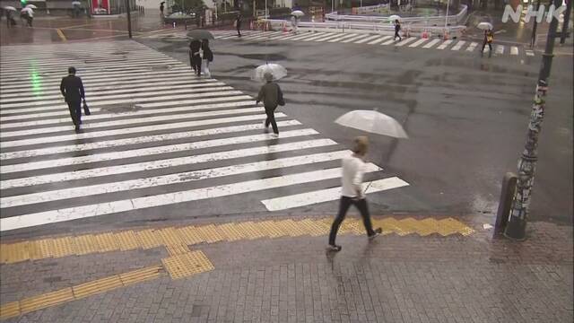
Tomorrow, there is a risk of heavy rain mainly on the pacific side of west and eastern Japan
Due to the influence of fronts and low pressure, developed
rain clouds are spotted on Kanto and Tokai regions. Over May 14th, heavy
rains may occur intermittently, especially on the Pacific side of western and
eastern of Japan, and the Japan Meteorological Agency is calling for careful
attention to sediment-related disasters and inundation of low land.
According to the Japan Meteorological Agency, it rains
mainly in eastern Japan due to the influence of fronts and low-pressure
systems, and developed rain clouds hang in the Kanto and Tokai regions.
Rain continues in western Japan, in Miyazaki and Kochi prefectures,
the amount of rainfall since the beginning of the rain on the 10th
of this month has exceeded 200mm.
On May 14th, another low-pressure system was
generated on the front line in the sea west of Kyushu and proceeded along the
pacific coast, so the atmospheric condition became unstable mainly on the
pacific side of western Japan and eastern Japan, and it rained intermittently
over a wide range. It is expected to strengthen.
Heavy rains are accompanied by lightning, and locally,
extremely heavy rains of 50 mm or more per hour can cause heavy rains.
The amount of rain in the 24 hours until the morning of May
14th is expected to be 200 mm in Tokai, 180 mm in southern Kyushu
and Kinki, and 150 mm in Okinawa, Amami, Shikoku and Kanto.
After that, the 24-hour rainfall from the morning of May 14th
to the morning of May 15th is expected to be 50 to 100 mm in
Okinawa, Tokai, and Kanto.
The Japan Meteorological Agency pays close attention to
sediment-related disasters, inundation of low land, flooding of rivers, and
also calls attention to severe gusts such as lightning strikes and tornadoes.
The time when it rains heavily may overlap with the time
when you commute to work or school in the morning, so please be sure to act
with plenty of time.
Source: https://www3.nhk.or.jp/news/html/20220513/k10013623961000.html
 English
 Japan
Japan
